For as long as I can remember, for as long as I’ve known what they were, I’ve wanted to see a total eclipse of the sun. Lunar eclipses are relatively common, and a little underwhelming; I’ve seen partial solar eclipses; they’re… OK, but I’ve always wanted to see the glowing corona.
Continue readingCategory Archives: Photography
Flooding on the Charles
We’ve had a ton of stormy weather over the past few weeks, and a lot of water has fallen, so it was not a surprise to see a river flood warning on my phone the other day. When I took a closer look at it, though, even though it was tagged for this town, it was in reality for Norfolk county, specifically the Dover-Medifield area.
I’ve become familiar with that area, first from rides on the motorcycle, and also from a number of kayak trips. My first drone flights were from the grounds of the old Medfield State Hospital. So I decided to head down and take a look. The alert mentioned some road flooding, but I figured I could always stop short and turn around.
Continue readingAgain, Sunrise at Castle Island
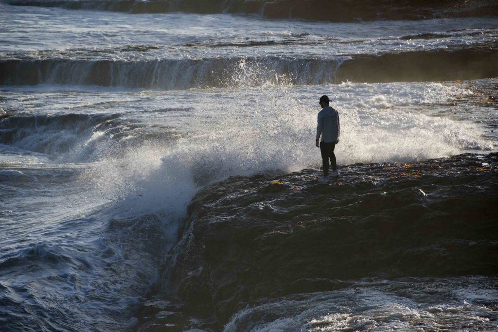
Today is once again, the last day of Daylight Savings Time. Just as the days have been ending earlier, they’ve also been starting later and later. With Daylight Savings Time, sunrise was at 7:20 this morning. So, just as I did last year, I decided to head over to Castle Island to see if I could see the sunrise.
Of course, dawn begins a lot earlier than sunrise, and as I learned today, it’s often more interesting than sunrise itself.
The forecast was for clouds overnight and today, but I woke up at 3 and could see the moon overhead, so I went back to bed and dozed for a little while. When I woke again at 5, I decided to take a chance, so I crawled back into my clothes and headed out for Castle Island.
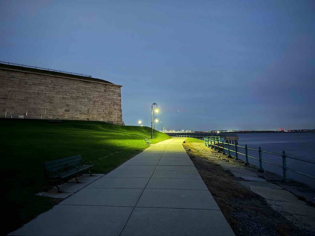
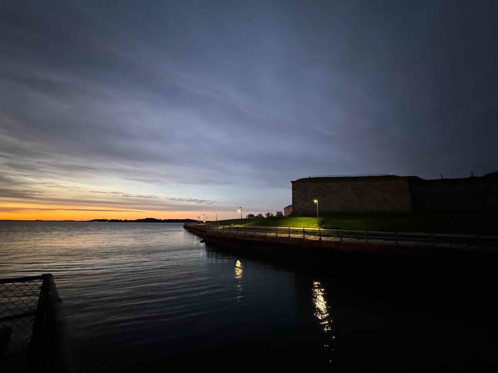
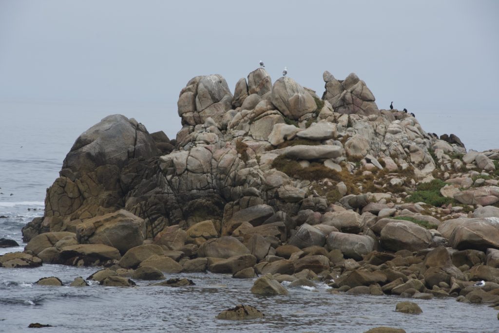
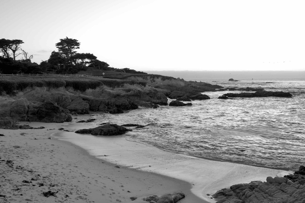
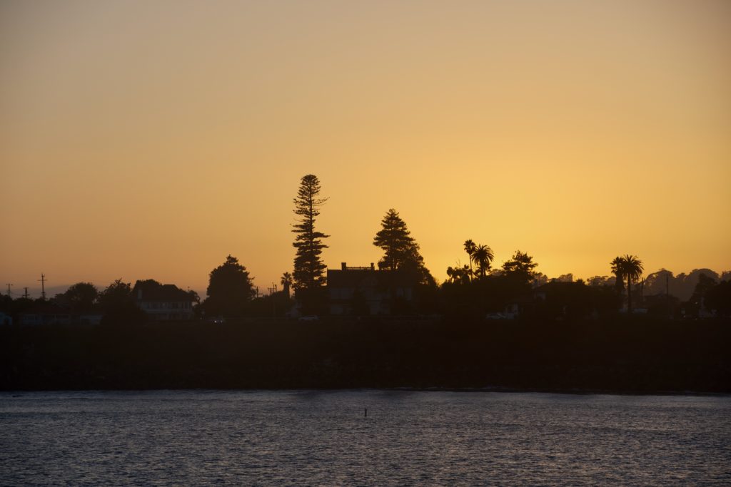
I got there in the just past six. It was quite dark out, so I did the morning’s Wordle, then decided to get out of the car and see if I’d wasted the trip. As I came around the corner of the fort, I saw it — a faint glow of pink to the east.
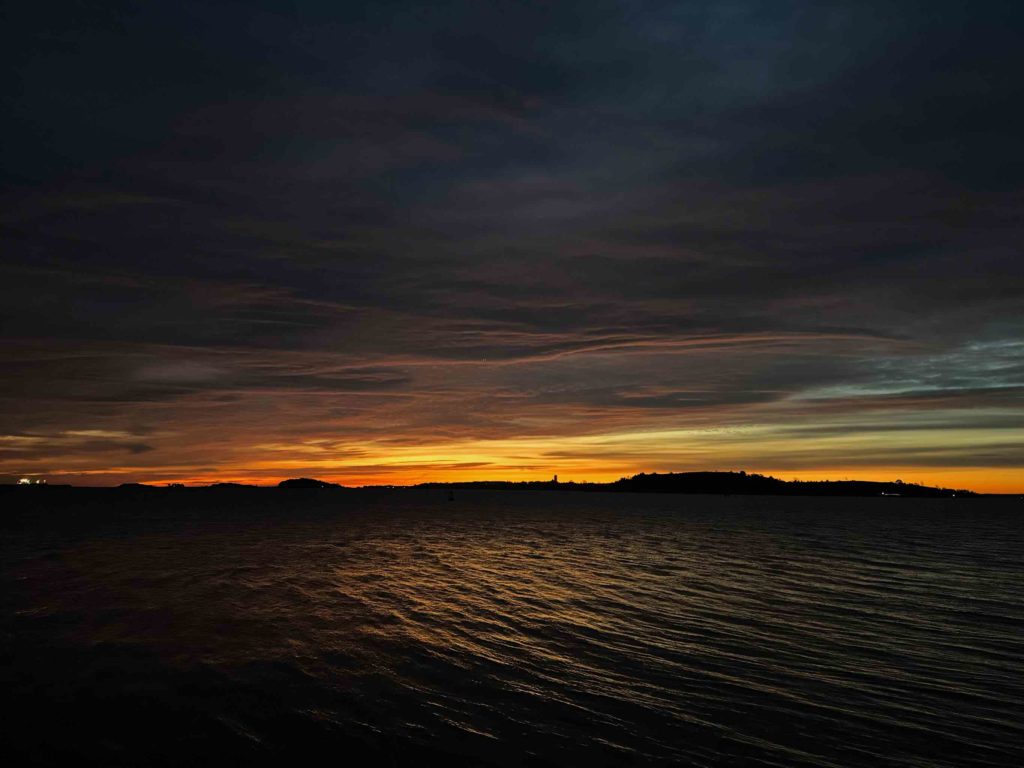
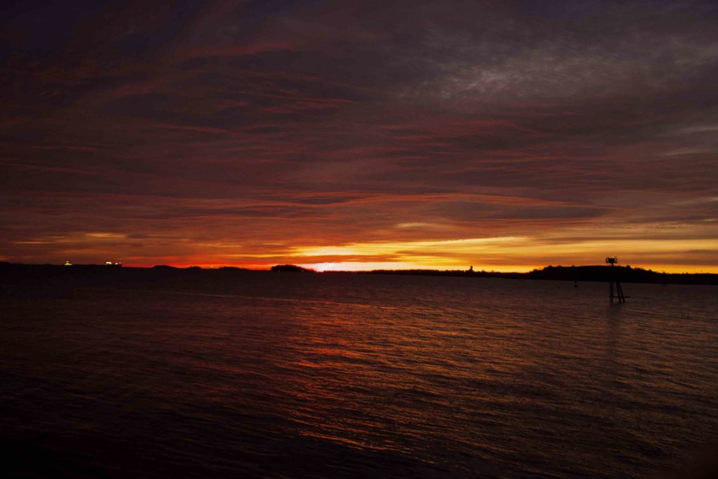
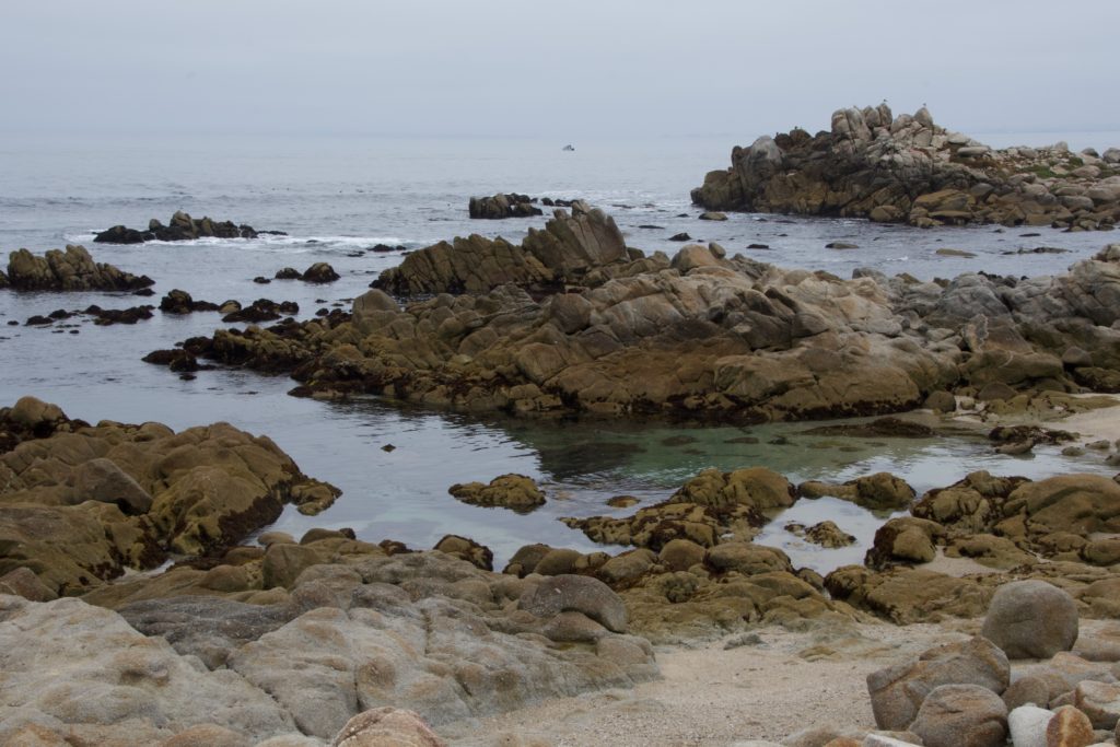
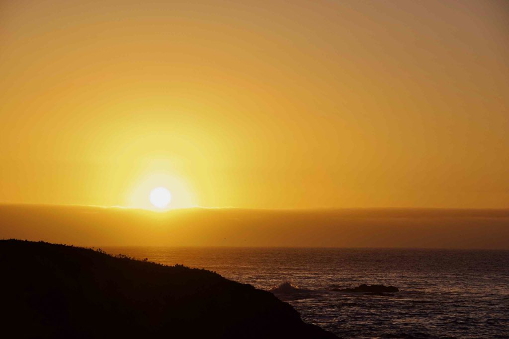
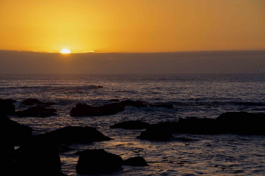
Gradually, the glow grew and got brighter. It became apparent that the clouds covered most of the sky, but there was a narrow clear band right at the eastern horizon. As the sun approached the horizon, it lit the bottoms of the clouds brilliantly. I could see layers and textures in the clouds. The color shifted from pink to orange as more and more green light mixed with the red. Finally, the sun rose, behind some light haze at the horizon — I never did see the actual disk of the sun — and the colors faded as the sun climbed behind the overcast.
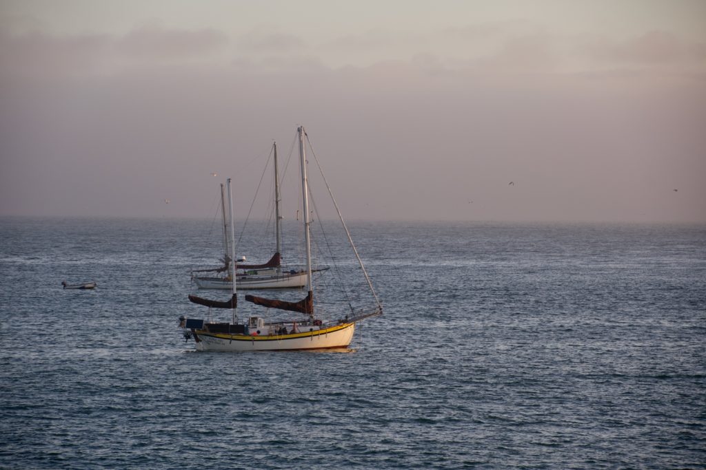
Just as it had a year ago, a tanker came into the harbor from the east. When I first got there, you could just barely see its lights, and then, just as the sun was rising it swept down the channel, made the turn, passed right in front of me, and then into the harbor. It turned out to be the very same tanker I’d seen last year, the Iver Prosperity. When I checked, it looks like it shuttles back and forth between Boston and St. John, Canada.


I was shooting with both the Nikon and the iPhone this morning, and it struck me how disparate they are. Neither one fits the bill completely. During the early part of the dawn, the SLR was nearly useless, as I’d neglected to bring the tripod, and I couldn’t hold it still enough not to blur the images.
The images out of the iPhone more resembled what I was seeing straight out of the camera, but it also tends to flatten the scene in a kind of paradoxical way. The iPhone shoot High Dynamic Range pictures, but then it maps the range of values into the gamut of what it can display. Granted, it can display a much wider range of values, but the end effect is a less contrasty image.
The Nikon, on the other hand, especially since I’m shooting RAW, just records the light values directly to the sensor. The end result is that, especially for a scene like a sunrise, is that it is impossible to record the highest highs and the lowest lows, and the pictures look more contrasty because the shadows are darker and the light areas lighter. You can pull some of the values back in in post-processing, but they’re still more contrasty. Compare the pictures of the clouds shot with the iPhone vs the ones shot with the Nikon — the Nikon better captures the textures of the clouds, while the phone did a better job with the colors. In addition, I have a longer lens available to me on the Nikon, and I tend to use it.
The other trade off with the Nikon is that since I am shooting RAW, I have to correct every damned picture. Apple Photos does not render Nikon RAW files well by default, especially ones like these that were not shot in the noon-day sun.
Once again, I’m impressed with the quality of the pictures coming out of this new phone compared to the ones shot on my old iPhone 12 Pro. Those pictures always looked over sharpened and sometimes had artifacts; I’m not seen it to the same extent with the new phone.
One other thing I have noticed in the new phone is a level indicator when shooting. I’m not sure if it’s new, and whether it’s an iOS 17 thing, or an iPhone 15 pro thing, or whether I simply never noticed it before, but it’s very helpful — when I think to use it. I keep grid lines turned on in the Nikon’s viewfinder, but I still find, when I look at what I’ve done, a lot of crooked horizons — and they’re particularly noticeable with a visible horizon line.
I think the next time I do something like this, I’ll bring the tripod. It was annoying not being able to use the Nikon during the earliest phase of the dawn. I know it’s capable of longer exposures if held steadily enough.
Despite the fact it was quite chilly, it was a good morning. I probably shot too many pictures, but I enjoy the process of shooting, and I had fun.
October on the Charles
Gallery
This gallery contains 31 photos.
One of my favorite times to be on the Charles River is in October, ideally when the fall foliage is at its peak. This has been a strange year — very very wet, and rainstorms most of the last several … Continue reading
Point Lobos
After packing up and checking out of our rental house, we headed over Point Lobos. It was a very pretty area, with lots of interesting rock formations. The morning had dawned foggy, but it pushed off-shore while we were there, though you could see the fog bank in the distance.


Big Sur
Today we planned to spend the day at Big Sur. The mountains come down close to the ocean there, creating a very picturesque landscape. There were a lot of things Tom wanted to show us.
Unfortunately, as we got closer, the fog closed in. We could barely see the Bixby Bridge as we crossed the bridge. We stopped at an overlook shortly thereafter; instead of the sea, we saw a sea of fog. The sun was just starting to burn off the fog above us, and with the sun behind us, looking down into the fog I saw my first glory; the water droplets in the fog created a slight rainbow effect around my shadow.
After a quick stop at the park offices, we stopped at Pfeiffer Beach. The fog was intense as we walked along the beach.


After Pfieffer Beach, we got back on the Pacific Coast highway and continued south, towards the McWay falls. As the day went on, and we climbed higher, the sun broke through the fog. As we turned the corner, we noticed an interesting phenomenon: it was wonderfully sunny up above (and in fact, I got a nasty sunburn on my face and head), but the coastline was covered by a solid bed of white fluff. This was especially noticeable from the balcony of the restaurant we ate at. When we finally got to McWay Falls, we could see the fog wafting through the trees, and could barely see the trees.


Tomorrow morning, we clean up, pack up, and take a look at Point Lobos before we head for the airport and home.
Pacific Grove and Carmel
I spent most of today walking around two different towns, Pacific Grove and Carmel.
Brian and the guys were golfing today at Pacific Grove Golf Course, and they needed to be dropped off. So I took them down, noticing on the way there that there was a nice downtown area. After dropping them off, I drove down to the waterfront, took some pictures, and then drove back downtown, had a coffee, then took a walk through the downtown area. There were several real estate offices, a couple of banks, and a few stores. It didn’t seem super touristy. I walked down to the waterfront, saw the Lover’s Point complex, and walked back to the car.


The town seemed nice, and clean, and the a fair number of the cottages appeared to be Victorian.
I then drove back to the time share to see if Tom was up and about. He was, so we decided to head up to Carmel, hoping that the Weston Gallery would be open, as I knew it had some Ansel Adams photographs. This was not a surprise, as their website said they were only open by appointment. I’d not made an appointment as I figured if someone was coming specifically in to work for us, there would be more of an expectation we would buy. But I’d hoped they’d be open anyway.


Carmel is a very pretty town. Kind of self-consciously so. It’s a more upscale town than Pacific Grove, and caters more to tourists. Tom and I did find another gallery with a couple of Adams prints, and ended up spending a couple of hours there, before we had to pick the guys up.
The rest of the group decided they wanted to see Carmel as well, so we went back up. In hindsight, I should have gone kayaking, as they ended up doing wine-tasting and not much else.
We did try to get over to Point Lobos after Carmel, but didn’t make it in time, so hopefully tomorrow, on the way to Big Sur.
Day 5: Redwoods and Monterey
We left Santa Cruz this morning to travel down to Monterey. Along the way, we stopped in the Henry Cowell Redwoods State Park.
The redwoods were immense, as expected. One goes there, expecting them to be huge, but still, the visceral impact of these huge trees is unexpected.


We first did a short loop through the state park, the various landmarks marked out by numbers corresponding to notes in a printed guide. Then we took a longer hike through a nearby forest, ending up by an abandoned limestone quarry.
Once we were through, we headed down to Monterey. The land got flatter, and much more agricultural. We passed fields and fields of crops. We stopped in the city of Montery; while the others had lunch, I wandered around a bit, and walked down to the wharf, where again, I saw several sea lions.
After doing a brief errand, we headed to the Air BnB. It’s quite nice; it’s faux rustic. From the outside it looks like a small shack, but it’s actually a couple of stories tall with several bedrooms and bathrooms and complete facilities. We’ll be based here for the rest of the trip. After a couple of hours of downtime, we headed back out for the sunset. We’ve all noticed that sunsets here are not as reddish as back east. My theory is that the Northeast is sort of the tailpipe of North America and we’re more apt to have dust and small particulates in the air, scattering the red light, while here, the air is coming off the Pacific. Nonetheless, it was still pretty.


Day 4 – Traveling to Santa Cruz
We spent Tuesday going down the coast from Pacifica to Santa Cruz. We stopped briefly at Half Moon Bay for a short ramble, took a detour to Cupertino to see the Apple Headquarters, went scootering in San Jose, got to see Tom’s place, then ended up in Santa Cruz for the end of the day.
We headed out of Pacifica, and started south. We took a side stop at Half Moon Bay, where there are walking paths through some woods and fields to the ocean.

Next stop was Apple Park in Cupertino. You can’t actually go into the Ring Building, but they have a Visitor Center where you can sort of see the Ring Building — enough to get a sense of the scale of it. It’s huge. The Visitor Center also has a diorama of the campus, and they have a virtual display with iPads showing a VR view of the various buildings. The top story is a really nice outdoor viewing area.

Typical Apple, the bathrooms in the visitor center are impeccably clean, sleek, and premium feeling, and you have to look carefully to figure out how to flush the damned toilet.
From Cupertino, it was a short trip to San Jose, where Brian wanted to give scootering a try. It didn’t last long; we scootering on the margins of the streets and the park, the park was full of homeless people.
From there, we stopped at Tom’s place. It was nice to get a sense of where he lives. We then checked in, and then headed for the coast.
Santa Cruz is sort of a coastal resort. There’s a big wharf, an amusement park, and it has the vibe of a blue-ish collar vacation town. Our first stop was Lighthouse Point, where there were a ton of surfers in the crashing waves. They were flying past the rocky point; it was amazing how good they were.


After watching the surfers for awhile, we then moved up the coast to the Natural Bridge beach. It’s small cove with a natural arch formation, and on the other side, some rock formations that the guys went climbing over


Our last stop was the Santa Cruz Wharf. This is a very long wharf jutting out about half a mile south into the Pacific. It has a bunch of touristy retail and restaurants on it. As I approached the end, I could hear sea lions barking — they were on the piles supporting the wharf. It was near sunset, so I got some sunset pictures, both of the sky, and of some boats anchored nearby. As dusk deepened, the lights came on at the amusement park across the water.


San Francisco, Day 3
This morning was another foggy morning. Actually, that’s an understatement; it was more of a heavy mist when we went down to the coffee spot by the beach.
The fog and moisture ruled out the hike Mike and Brian wanted to do, so we decided to see Fisherman’s Pier in San Francisco.
The pier reminded me very much of Chatham or Provincetown, in that there is a lot of retail aimed at the tourist. There’s a wax museum, which we didn’t have time to see, and a ton of restaurants.
The pier faces to the North into San Francisco Bay; you can look to the North to Alcatraz, or to the East to the Oakland Bay Bridge. The road bordering the Pier has a historic streetcar line running PCC cars in historic livery. On one of the wharves, sea lions haul out of the water and sun themselves. Pelican are overhead and perched on the docks, and there’s a World War II submarine, the USS Pampanito, there.


The fog burned off briefly while we were there; by the time we’d had lunch, the sky had cleared, leaving a line of low clouds on the horizon.
We didn’t have much time to explore any of the shops or museums because we had reservations to go on a Segway tour of Golden Gate Park at two. Riding the Segway was cool, although I did have a spill once when I had trouble steering it, and by the time we were done, my feet were killing me. You’re basically just standing on it, not moving your feet, and I brought the wrong pair of sneakers out with me, so they have very little resilience left.
Golden Gate park itself is very cool — lots of different kinds of botanical displays, a Ferris wheel, a band stand, and an art museum. It’s also very very large. You could easily spend days here, exploring. As it was we got an overview of the whole thing. We weren’t able to take pictures during the tour, so I had to content myself with some pictures when the other guys first tried it out, and a picture at one of our brief stops, and an overview picture when we were done.


After we were done, we headed for the Beach Chalet, a restaurant across from the beach on the western side of San Francisco. The service was great, and we had great view of sunset.