Around the start of the last century, water shortages in Greater Boston caused the state government to look to Western Massachusetts for supplies of clean drinking water. The Wachusett Reservoir was completed around 1908, and in the Twenties, the people of the Swift River valley lost their battle against eastern Massachusetts, and construction of the Quabbin Reservoir begun. The towns of Enfield, Greenwich, Prescott and Dana were disincorporated, their citizens evicted from their homes, and all structures in the way of the future reservoir razed. Construction took place during the thirties, and the reservoir filled during the forties, becoming the largest inland body of water within the Commonwealth of Massachusetts.
Today, it supplies most of eastern Massachusetts with water. To protect the water, the area around it is a reservation. Yesterday, I took the motorcycle out for a ride around there. The roads around the reservoir are great for motorcycling — curvy, and not too crowded.
I took the fastest route out there, via the Massachusetts Turnpike to Palmer. From there, I took Route 32 north to Route 9, and entered the reservation through the eastern entrance.
My first stop was Hank’s Meadow, a long grassy meadow with a view down to the shoreline. The reservoir is at about 86% capacity right now, so there’s a small band of exposed rocks at the water’s edge.
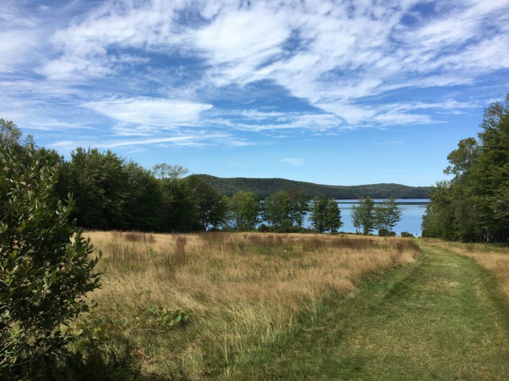
View from Hank’s Meadow
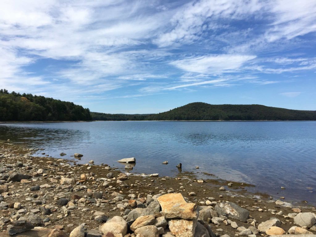
Water’s edge at Hank’s Meadow
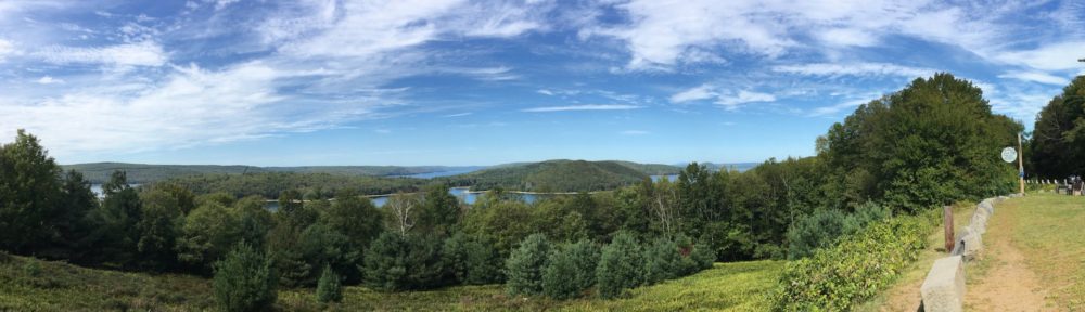
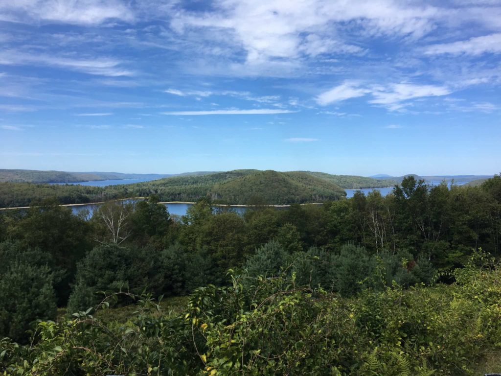
From there, I got back on the bike, and headed towards the Enfield Lookout. From the lookout, you can look north out over the reservoir, to where the Town of Enfield used to be.
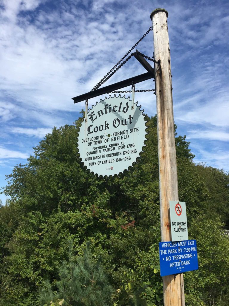
Sign for the Enfield Lookout
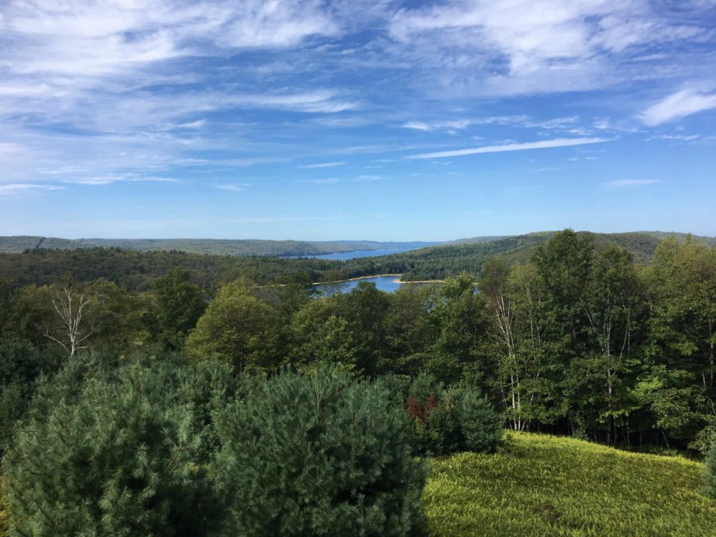
Enfield Lookout
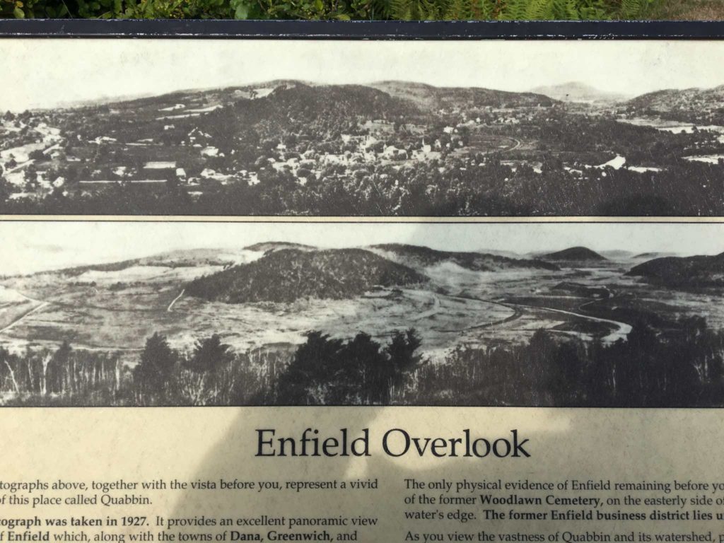
View from lookout, before and during construction
What used to be Enfield
From the outlook, I rode to the lookout tower, then past the Winsor Spillway, where excess water is allowed to rejoin the Swift River, parked, and walked up to the Winsor Dam — since the 9/11 attacks, you haven’t been allowed to drive near either the dam or the Goodnough Dike, which impounds the rest of the reservoir.
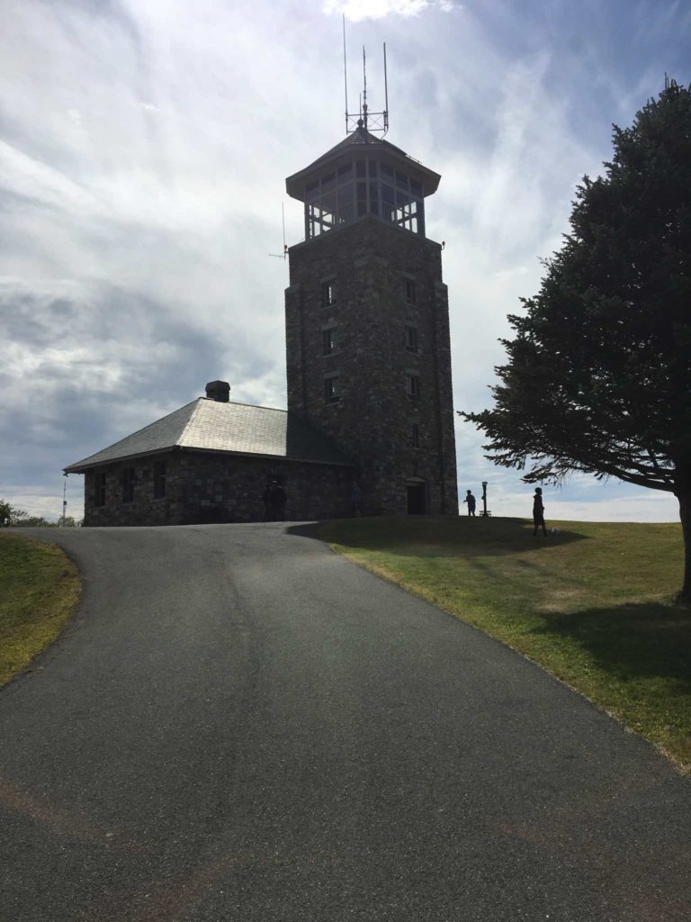
Quabbin Lookout Tower and high clouds from the remains of Harvey
Windsor Dam spillway

Winsor Dam, which is a high earthen dam impounding the Swift River
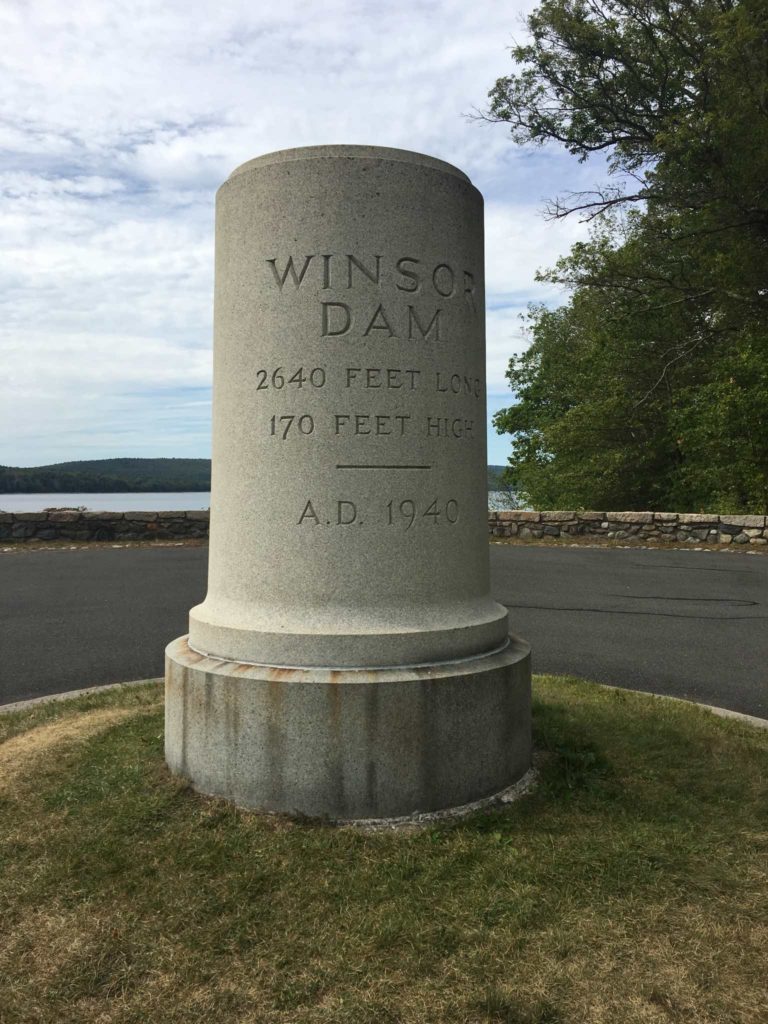
Marker for the Dam
I only walked a short distance over the dam; by then it was getting close to 3:30 and I was getting hungry, so I exited the reservation and took Route 9 to 202 south, and had a hamburger and ice cream at a local restaurant. Then I headed back north on 202 towards the actual goal of the ride – the roads around Quabbin.
The roads around the reservoir are great for motorcycling – curvy, scenic, and at least yesterday, not too crowded. They’re also in good condition. From the restaurant, I headed north on 202, past Route 9 where I’d come from (Route 9 in this area is itself a fun, scenic ride – nothing like the honky-tonk of Framingham and Natick), north along the western edge of the reservoir. There are turnouts at various places along the road, but the reservoir is only visible in a few spots along the road. What you mostly see is the woods.
Once I reached Route 122, I turned right onto it, and started heading east. Route 122 is another great road – curvy, little traffic. There are a couple of turnouts that would allow you to hike into what were once Dana and Prescott, but by this point, I wanted to get going. In Barre, I switched onto Route 62 for the ride home. I’d been a little worried about finding it, because the last time I’d been this way I’d gotten a little lost, but I picked it up in the center of Barre without any trouble.
Most of Route 62 is pretty scenic too. It’s a lot hillier than the other roads — there was one long steep downhill, and then a steep uphill. There were also a couple of sections where I got stuck behind someone driving under the speed limit.
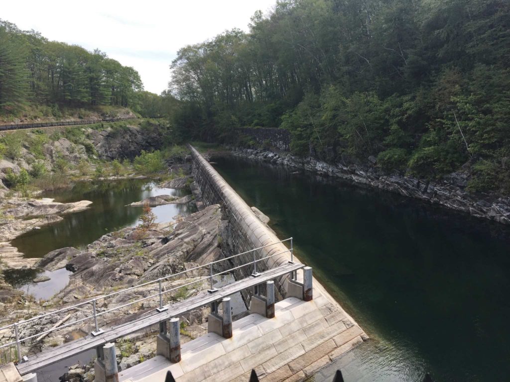
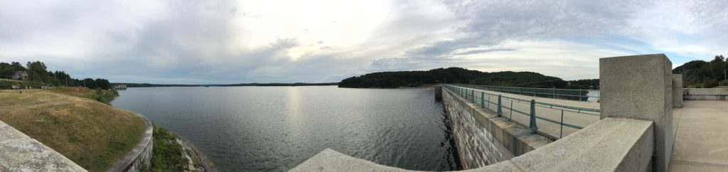
Route 62 also runs through a couple of towns; I went through the centers of Hudson and Clinton, and passed along a bike path along the way. As I was exiting Clinton, I saw a big dam up ahead; it was the Wachusett Dam, with Wachusett Reservoir behind it. Of course, I had to stop to look and take a couple of pictures. The dam is tall and imposing, blocking a narrow valley with a narrow river and fountain below, and the reservoir above.
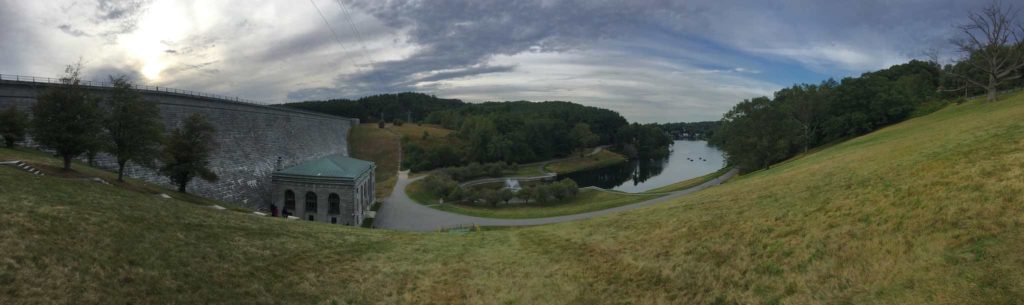
Panorama downstream of the Wachusett Dam
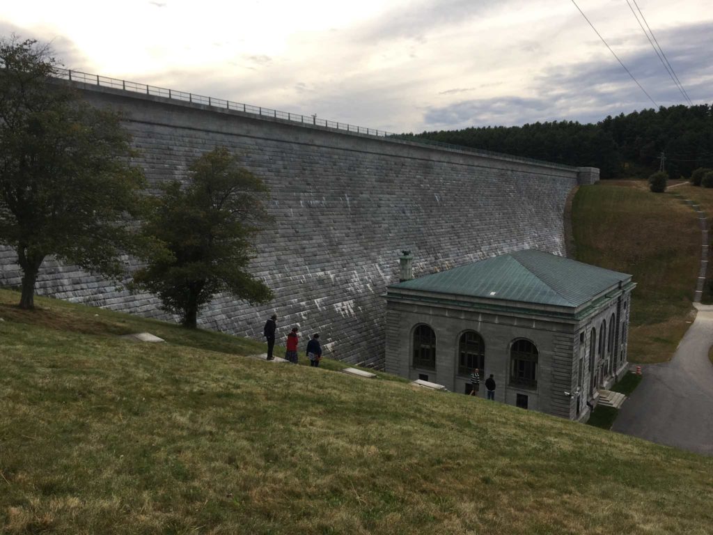
Wachusett Dam
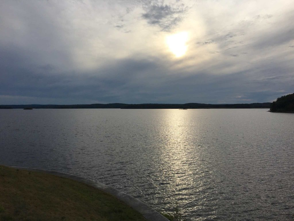
Wachusett Reservoir near dusk
Wachusett Reservoir
From Clinton, I followed Route 62 back to Route 2, back to Route 128 and home. All in all, a good day’s ride.