One of the the things you learn quickly when you come to Cape Cod regularly is that erosion is a fact of life. Each year, the ocean side loses a few feet, and often, the Bay side is hard hit too. There once was an island outside Wellfleet Harbor called Billingsgate Island, but all that remains now is a sandbar, visible only at low tide.
Billingsgate was populated relatively recently – during the eighteenth and nineteenth centuries, it was a little village, complete with houses, a breakwater and a lighthouse. Erosion split the island in two in 1855, and the last of the families moved off the island in the early 1900s. The last lighthouse was torn down in 1922, and erosion claimed the rest of the island in the late thirties or forties, though highway maps as late as the sixties continued to show the island.
I’ve long been been fascinated by the story of Billingsgate, and seeing a blog post by a pair of kayakers helped spur me to buy my own.
Today, I finally made it out there. It was my last day on the Cape, and the tides were propitious — low tide was around 10:30 in the morning. I decided to leave from Wellfleet Harbor, crossing the greater harbor inlet and then following the contours of Great Island and Jeremy Point. It was my first open water trip that I planned for myself, and the first time I took the kayak out onto the bay.
Unfortunately, I got off to a later start than expected, and didn’t leave the harbor until about 9:20 or so. Great Island looks pretty close to the harbor, but looks are deceiving. I never really got particularly close to it, but I cut diagonally across the water towards it. As I got closer, I bent my course more and more towards the end of the islands.
The whole outbound trip, I was very conscious that I’d left the beach about an hour later than was optimal for today’s tide. I was going a long ways out, and would have to paddle a long way back. I couldn’t pour on the coal to get there faster; I had to leave enough in my arms to get me back to the beach. I didn’t know how long it would take; would I get there too late to see anything? And if I did get there in time, would I have time to see anything? Once the tide turns in Cape Cod Bay, it starts coming in fast; I was very wary of pulling the boat onto the sand, going off to take pictures, and coming back to see that it had already floated off into the water.
As I continued outbound, I saw what looked like a raised sandbar with some rocks on it. Was that it? I thought I saw people there. As I got closer, though, the “rocks” became greener and greener, and I realized I was seeing eelgrass on Jeremy Point.
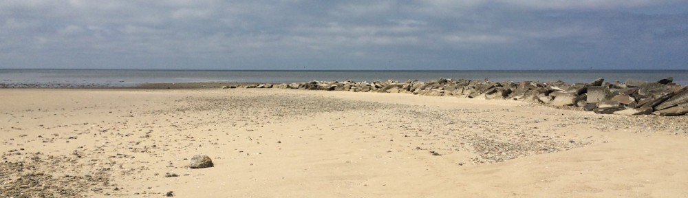
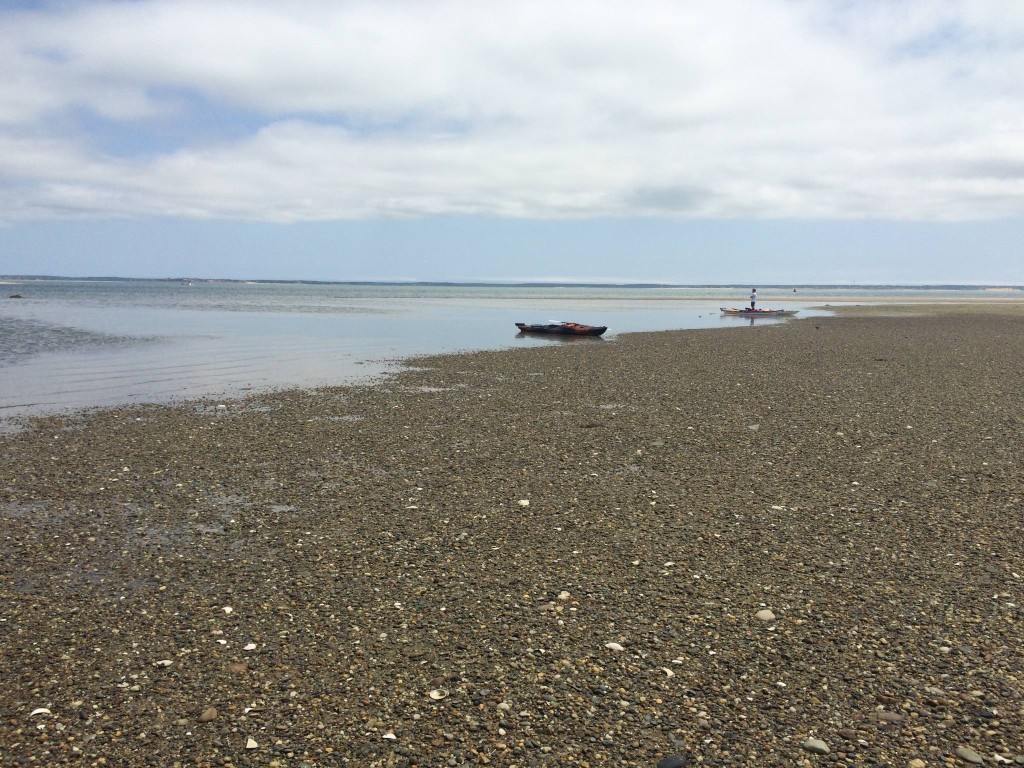
Another pair of paddlers caught up to me and passed me. (I am not fast, at least, not yet). I watched their progress with interest. Finally, I started to notice a piece of the horizon was yellower than it should be; after a while it started to resolve into a sandbar, with what looked like junk on it. Billingsgate Island was in view. As I got closer, I could see the rocks that made up the old breakwater.
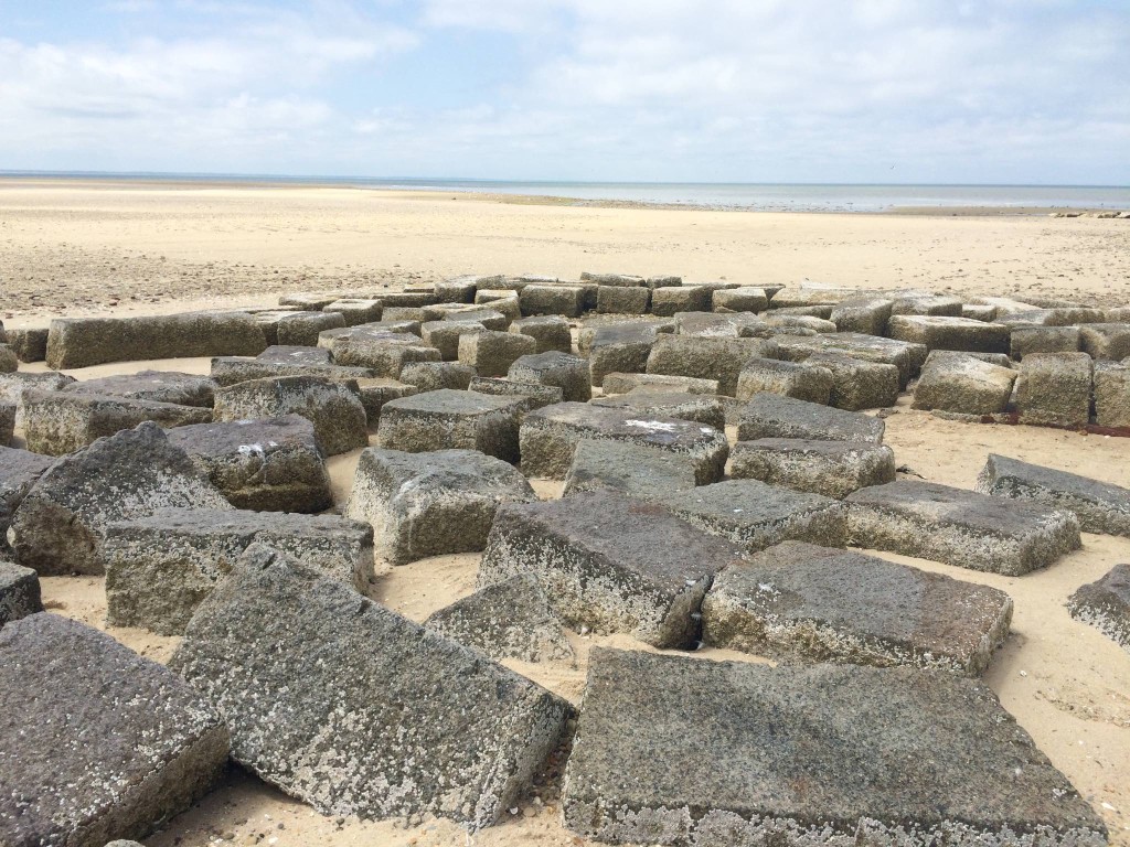
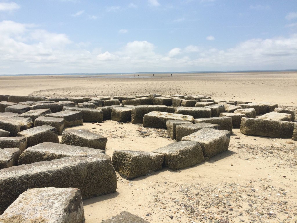
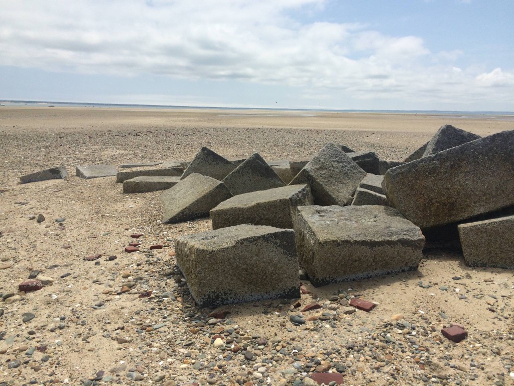
At this point, it was about 11- 11:15 or so. Half an hour after high tide, and I still had quite a ways to go. The kayakers ahead of me seemed to look at the sandbar ahead of me, then went around the side. This turned out to be sensible; the sandbar was actually two sandbars, and I wanted to be fairly close to the ruins of the lighthouse and breakwater. Onward. The water by the split was surprisingly tumultuous, and then I was past it and approaching the main island. I saw that the couple ahead of me had landed; one person was tending their kayaks, and the other was snorkeling. Finally, just after 11:30, I beached the kayak, and pulled it up about 30 feet onto the sand, and trotted over to see what was left of the breakwater and lighthouse.
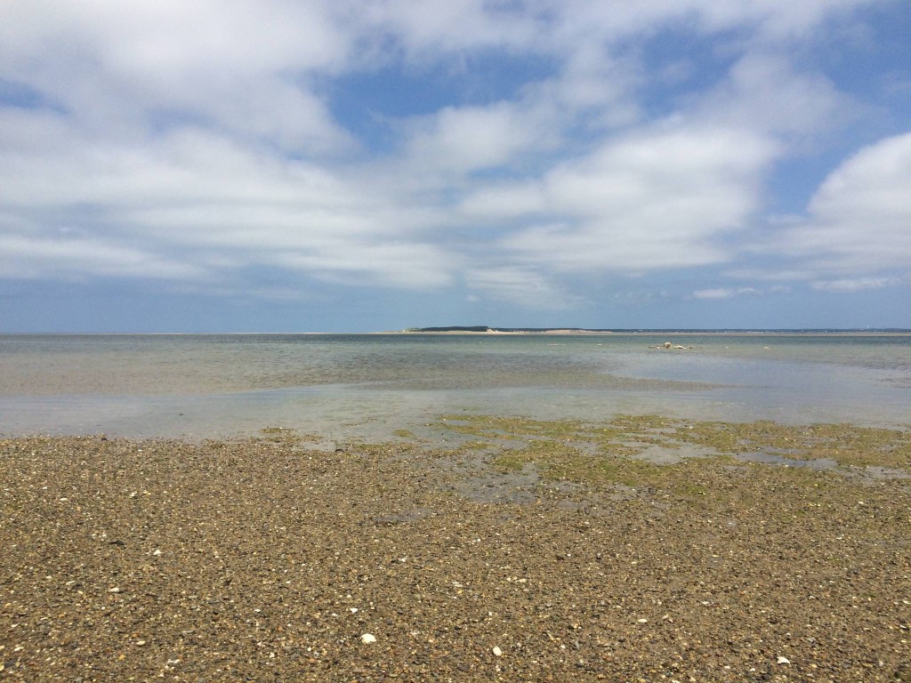
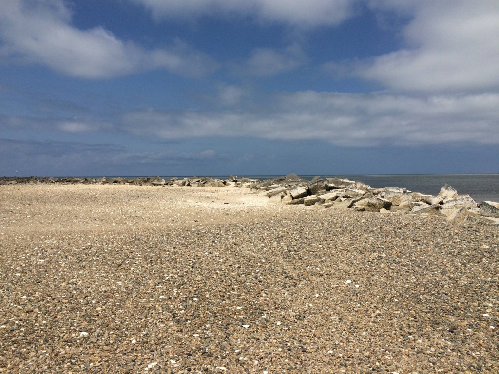
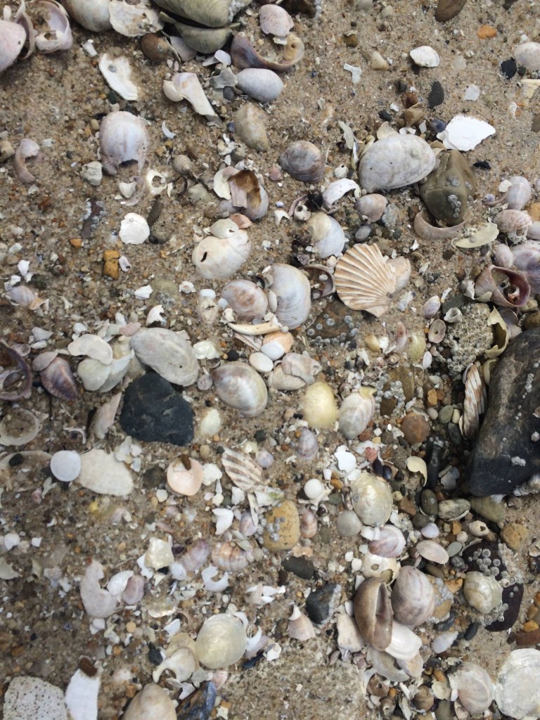
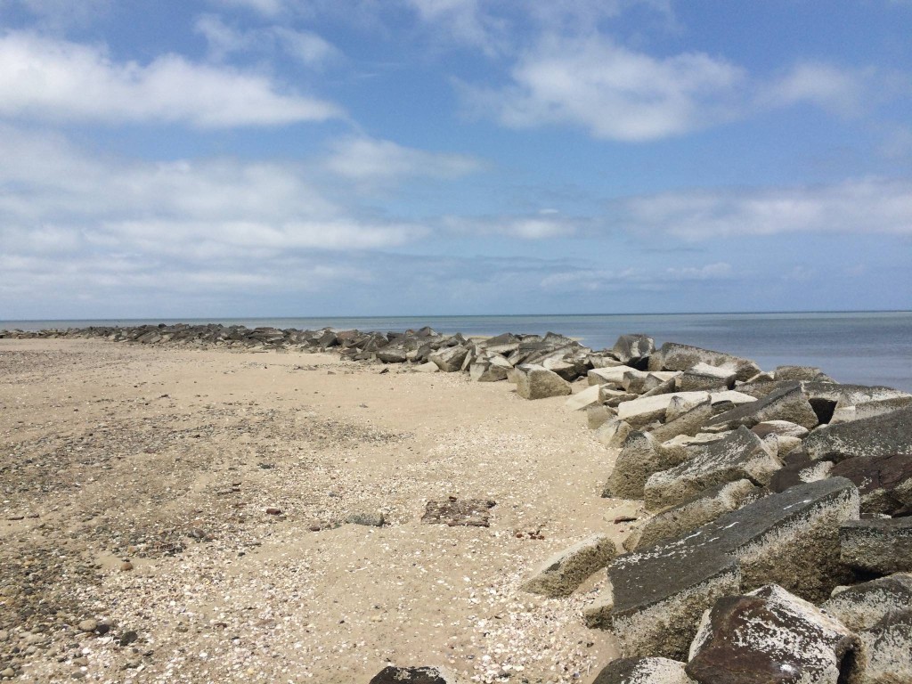
I was really surprised just how large the shoal was. It was pretty big—I could see some boaters far off, on the other side, in the distance. I was also surprised by the composition of the sandbar. Most sandbars on the Cape are made of fine sand; this one, probably because it’s the remnant of a landmass, was quite pebbly, and also littered with shells.
I just had time to walk around a little of the breakwater and take a couple of pictures of the foundation stones when I looked back and saw the kayak was already at water’s edge. I could have pulled it further back, but I’d already gotten what I wanted, so I got back in the boat and started drifting back north. As I got closer to the northern edge, I saw a seal near the edge of the water, sunning itself, and another swimming past.
The trip back was easier than the way out. The incoming tide was pushing me into the harbor, and waves from astern would lift the boat, and I’d be momentarily surfing. I was very glad to have a rudder. It was a little bumpy at times–there were a few swells, but the boat generally handled them well. I was unsure of exactly where the harbor was, but knew that once I was back inside Jeremy Point, at worst, I could parallel the shore and get back that way. I could see the Wellfleet water tower and assumed the harbor was in that general direction and that as I got closer, boat traffic would show me where to go; this proved to be correct.
Overall, I’m very pleased with the trip. When I do it again, and I will do it again, I’ll leave myself enough time to arrive there as the tide is still falling, rather than when it’s on the way back in, so I have more time to walk around. Next time, I’ll bring the PowerShot in its housing, so I can take pictures while underway, without worrying about getting the phone wet. I need to get a deck compass, and I need to learn how to use the equipment better, but I now know I can do it, how long it takes, and what to expect.